Topography maps are game changers for anyone out on a hiking or backpacking trip. These maps aren’t just pieces of paper with a bunch of lines; they’re detailed representations of the terrain you’ll be tackling. From elevation changes to water sources, knowing how to read and use these maps can make the difference between a great adventure and a risky situation.
The essential role of topography maps in navigation can’t be overstated. They give a clear picture of the landscape, allowing you to plan your route and identify potential challenges. Need to find the best path through a mountain range? A topography map has you covered.
Ignoring the importance of a topography map can lead to serious risks. Without a reliable navigation tool, even the most experienced hikers can get disoriented. A sudden change in weather, an unexpected obstacle, or simply taking a wrong turn can leave you feeling lost.
Even the best and most experienced hikers can lose their way. That’s a hard truth. Familiar trails can look entirely different in adverse conditions or after dark. This is why a topography map is crucial – it provides a reference point and helps you stay oriented.
Real-life scenarios drive home the importance of these maps. There have been countless stories of hikers using topography maps to find their way back after getting off track. In emergencies, having access to a topography map has helped people locate water sources, safe resting spots, and paths back to civilization.
Choosing the Right Topography Map for Your Adventure
Selecting the proper topography map is essential before you set off. You need a map that covers your hiking area in detail and provides pathways that lead out of the main hiking zone. This ensures you can handle unexpected detours or changes to your planned route.
It’s not just about picking any map of the area. The region’s distance and connectivity to surrounding areas might necessitate multiple maps, especially on longer treks crossing different territories or state lines.
Obtaining reliable topography maps is crucial. Topography maps from verified sources such as local wilderness offices, park visitor centers, or reputable online sellers are your best bet. These sources usually offer the most accurate and up-to-date information. Some specialized stores even provide customizable maps to fit your specific hiking needs.
Customizing maps for extended hikes is a smart move. If you’re planning a longer trip, customization allows you to combine multiple maps into a comprehensive guide. This might mean including detailed information about water sources, steep terrains, campsites, or other critical features relevant to your journey. Having these details on a single, cohesive map can be a real lifesaver when you’re deep into your trek.
Using a Baseplate Compass with a Topography Map
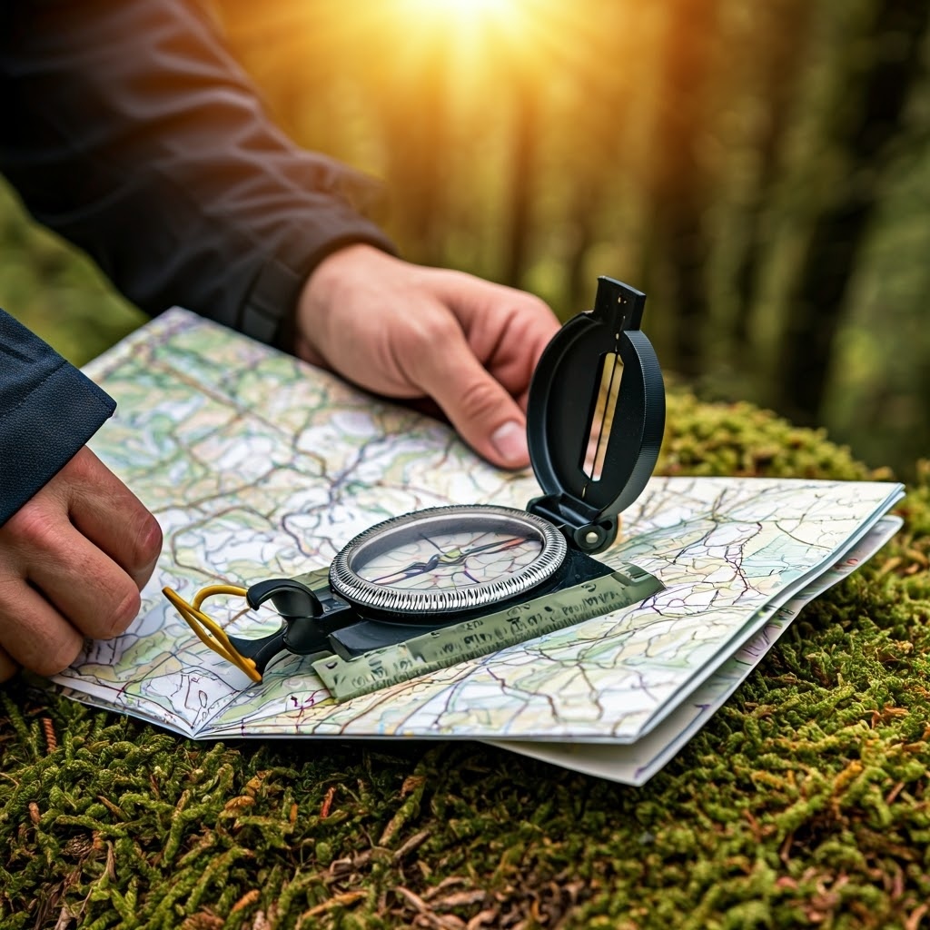
A baseplate compass is an essential companion to your topography map. While the map provides the lay of the land, the compass helps you orient yourself within that landscape. Together, they form a reliable navigation system that keeps you on track even in challenging conditions.
Understanding True North vs Magnetic North is critical. A baseplate compass always points to Magnetic North, which differs from True North. The difference is called declination and varies depending on your location. Knowing how to account for this difference ensures your navigation is accurate.
Determining the degree of declination is straightforward. Most topography maps include this information in the legend. Once you have the degree of declination, you can adjust your compass readings by adding or subtracting this value, depending on whether it’s east or west of True North.
Using a baseplate compass effectively involves a few steps. First, align the compass with the map’s north. Then, rotate the map and compass together until the needle points to the adjusted north, accounting for declination. This way, the map is correctly oriented with the terrain around you.
Examples of calculating and applying declination can make this clearer. For instance, if your map shows a declination of 10 degrees east, you’d adjust your compass reading by subtracting 10 degrees to find True North. This adjustment ensures that your map’s orientation matches the real world, guiding you accurately on your hike.
Practical tips for using a baseplate compass include keeping the compass level for accurate readings and avoiding metal objects that might interfere with the needle. Practice these steps before hitting the trail to make sure you’re confident in your navigational skills.
In compliance with the FTC guidelines, please assume the following about links and posts on this site: Any/all of the links fourseasonshiking.com are affiliate links of which I receive a small compensation from sales of certain items.

Learn More, Click the Link Above

Great article! I appreciate how you broke down the importance of topography maps for hiking and backpacking. As someone who’s still learning the ropes of outdoor adventures, this was super helpful. Your tips on reading contour lines and understanding elevation changes are spot on. I’ve had a few hikes where I wish I’d been more prepared, and having this knowledge would have made a big difference. Thanks for sharing such practical advice! Looking forward to more of your insights on hiking essentials.
Thank you, It’s nice to hear that the article has benefitted you!
Lonnie
Thanks for a great article that drums home the importance of topography maps when hiking. Hiking is about being prepared for the worst case scenario and getting lost can happen. It’s being able to get yourself out of a bad situation that matters. Relying on technology is not the wisest of options and map reading is an essential skill. Your explanations made things very clear. Thanks.
Yes, a compass and a map can help one find their way to safety, if, we know how to use both together.
Sincerely, Lonnie